Showing posts with label Cherry. Show all posts

Friday, September 12, 2014

Upper Cherry the Hard Way

Sometimes victories earned over extra obstacles are the sweetest; however, in the case of Upper Cherry Creek, the standard version involves an 11 mile hike to the put in, providing plenty of suffering for even the most hardened masochist. Unfortunately, the Rim Fire of 2013 burned large sections of the Stanislaus National Forest, resulting in subsequent closures for the summer of 2014. Despite that the Upper Cherry Canyon remained unburned (it's hard to burn granite), the roads used to access the put in trail and take out at Cherry Lake were closed, so we hatched an alternative plan.

Bourland Meadows, a trailhead on the west rim of West Cherry Creek, was still accessible and was only about 4 miles from Upper Cherry Creek as the crow flies. After a quick look at the satellite images for the area we discerned that most of the hike could be done on open granite and there was a small pass between West Cherry and Cherry Creeks we could use to prevent significant additional elevation gain at the expense of extending the hike to 4.5 miles. So we had a way in, but the way out was not pretty.

The closure extended to just above the confluence of West Cherry and Cherry Creeks, and all potential access points further down towards the lake were also closed. Sometimes lack of options brings clarity. We would be taking out just above the confluence and hiking back up the West Cherry Canyon to Bourland Meadows, a hike of 7 miles and about 2500 ft. gain with no trail but significant open granite. And that was the plan. We knew it would be brutal but there weren't any other options for kayaking in California, so we we're in. We tried briefly to wrangle a few others in, but no one was convinced about all the off trail hiking, so we set off as a team of two.

We were planning to hike one day, kayak a day and a half, and then hike out that afternoon. Instead we got an extremely late start out of Sacramento, resulting in having to call ahead for our wilderness permit since we weren't going to make it by the 5 o'clock close. The open roads to Bourland Meadows were pretty burly and we didn't arrive until 7:30 pm, so we decided to camp there and start early for a two day mission.

We didn't wake up quite as early as planned, but we were still walking by 8 am. We started out on the trail, figuring we had almost a mile until we'd be breaking off based on topo maps. Instead, the trail kept going the direction we wanted to head, so we kept following it for about an hour until we gained an expansive view of the West Cherry canyon. We did a quick map check, confirming the notch we saw upstream and on the far side of the valley was what we wanted, and took off down the slab aiming for just below a forested section of creek. We quickly reached the creek and hopped in our boats to cross to keep our feet dry before continuing upstream across the slabs towards the pass. About an hour's push saw 
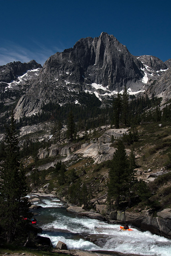
us to the pass and our first view of Upper Cherry Creek.

 JJ taking a rest on the pass between West Cherry and Cherry Creeks.  Photo: TJ

 TJ excited that we can finally see our destination.  Photo: JJ
We took a good long break at the top before heading down into the first Manzenita of the hike. There were little game trails occasionally, but there was also some serious bushwhacking. Hindsight suggests that maybe traversing left at the pass would be easier, but the 15 minutes of Manzenita wasn't too bad either. Eventually, we regained the open granite and made good time to the river while avoiding a few swampy areas. It was only 12:30 and the hike was about as easy as an off trail hike in the California wilderness could be, so we took a quick dip and ate lunch thrilled to have made the river so quickly.


TJ coming down the slabs.  Photo: JJ


TJ figuring out where to navigate this swampy area.  Photo: JJ


Our put in.  Photo: TJ

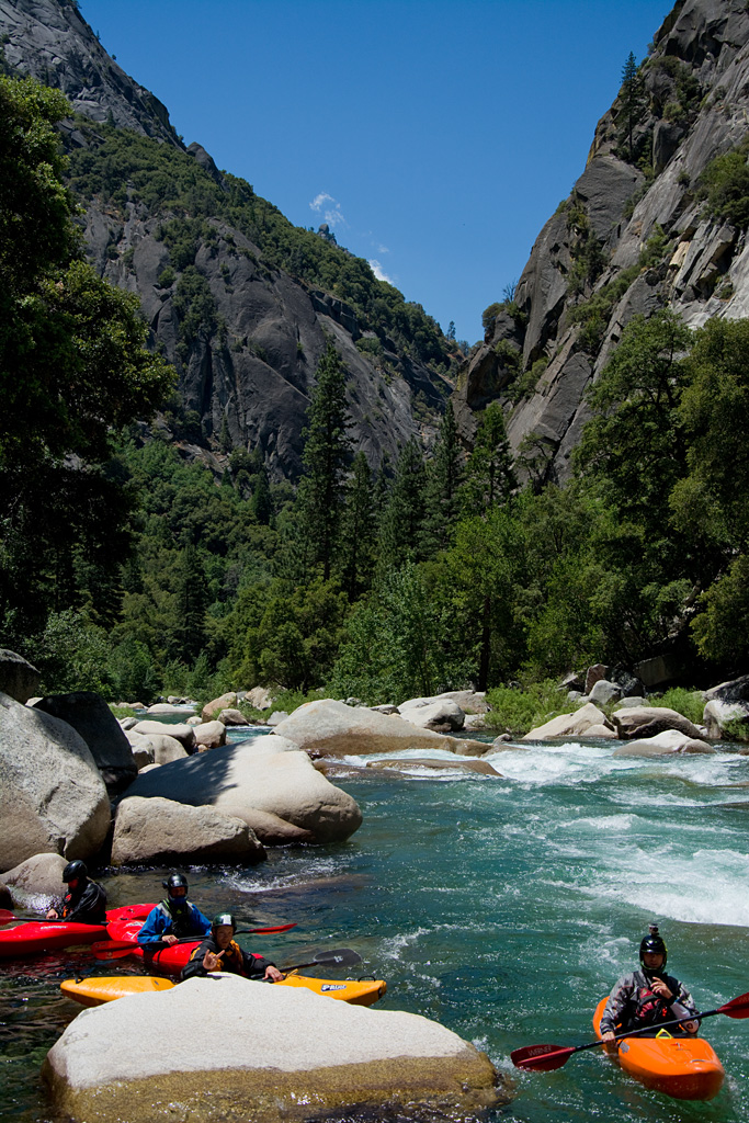
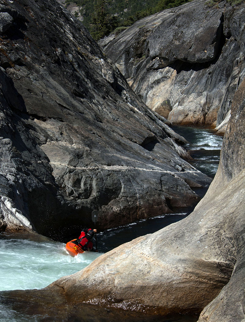
After lunch we geared up and hopped in our boats, not knowing exactly where in the run we were other than we were below the put in slide and above Cherry Bomb Gorge. We started off with wide open granite before things quickly tightened up into classic California slides. Soon, we reached (and portaged) our first major rapid: West Coast Gorilla. We now knew where we were and that our hike had dropped us in about half a mile above the Gorilla. We continued on with lots of great slides and little scouting since we had both done the creek 2 times previously. Despite the slightly low flow, the kayaking on Upper Cherry is phenomenal in the fun department with very little stress, so much so that we were pretty much giggling at times.

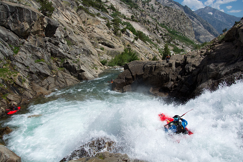
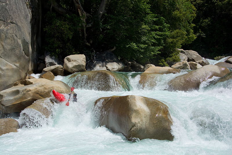
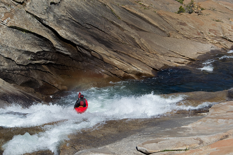
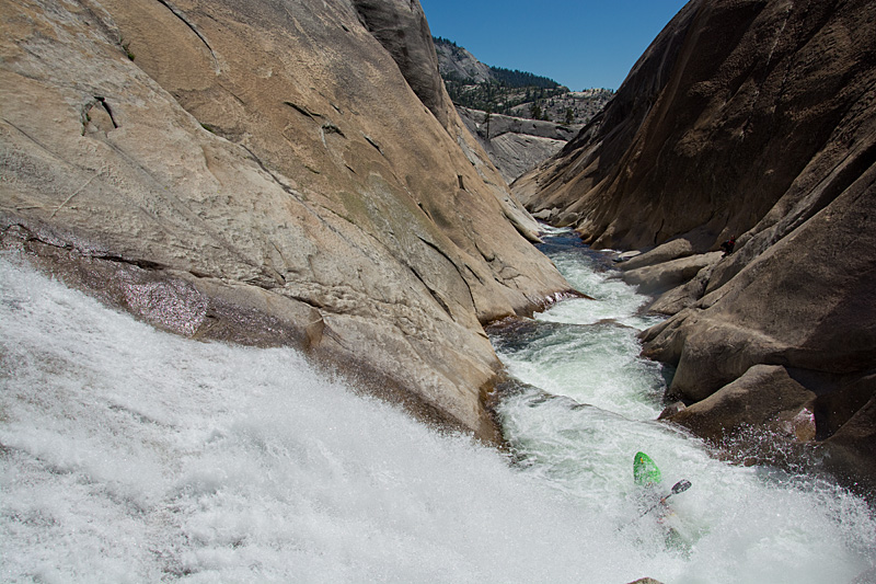
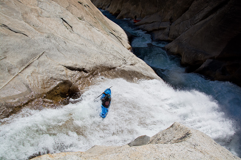
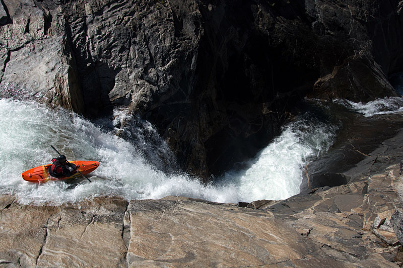
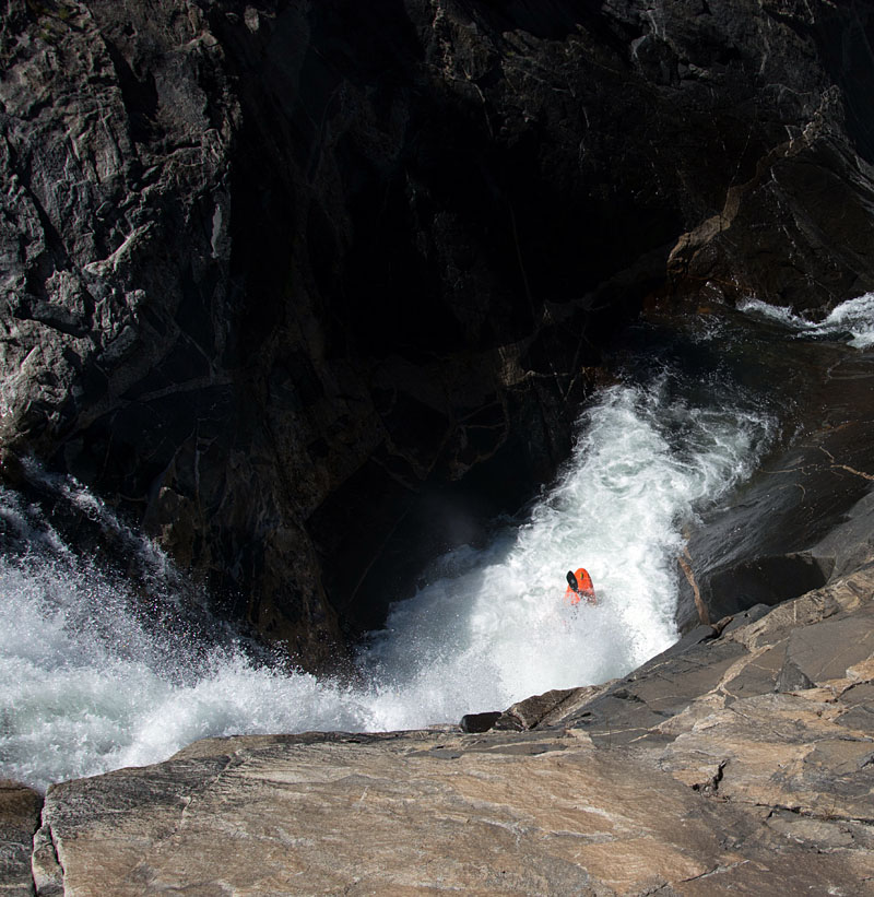
Upper Cherry gets slightly more serious as you approach and pass through Cherry Bomb Gorge, where the creek has carved it's way between two 500 ft. domes resulting in a ultra-committing canyon with no opportunity for egress. Fortunately, the boating in Cherry Bomb Gorge is of the highest quality and at low 
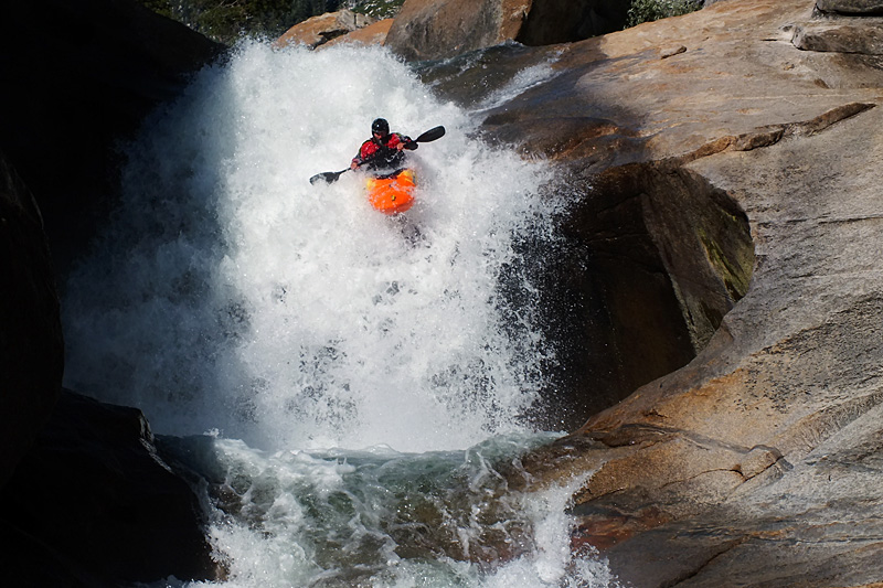
flows not too difficult other than Cherry Bomb Falls. After a quick portage to the top of the falls, we dropped in, avoiding the pothole on the wall and the subsequent weir hole. The rest of the gorge was 
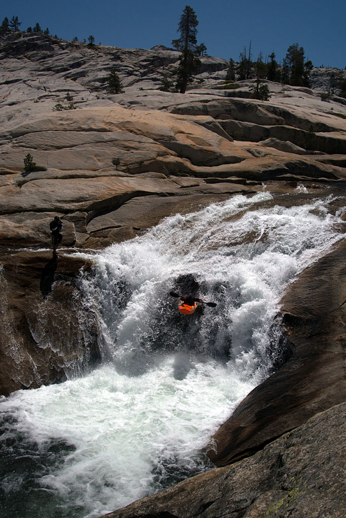
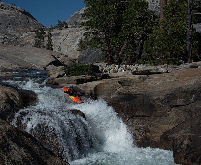
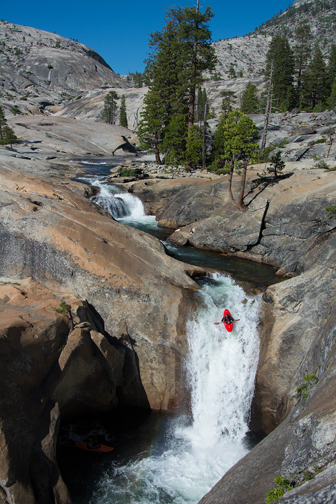
smooth and we continued rallying down through the big slide and the teacup waterfalls above Flintstone Lake. We were all smiles as we pulled into camp with the place to ourselves and the rest of the afternoon to walk back up and lap the big slide and teacups. We 
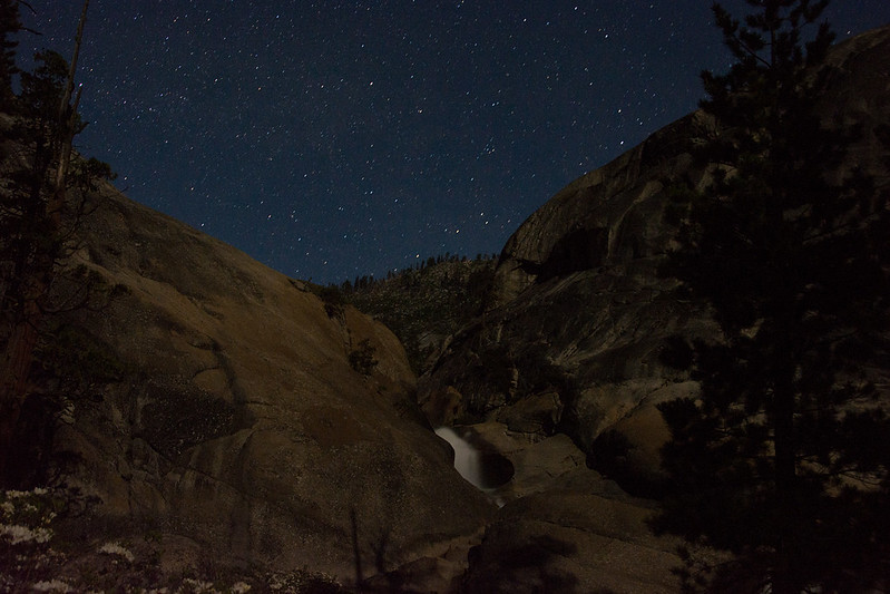
cooked up a little dinner over the fire and the full moon emerged, lighting up the canyon. It didn't take much brotherly jeering before we were walking back up for some moonlight laps on the teacups.


TJ starting in on the big slide.  Photo: JJ


About to catch some air.  Photo: JJ


The bottom of the big slide.  Photo: JJ


Suns out, guns out.  Photo: JJ


This one has a nice twisting entrance.  Photo: JJ


Ready for landing.  Photo: JJ


JJ just below the big slide.  Photo: TJ


JJ on another perfect teacup.  Photo: TJ


From another angle.  Photo: JJ


Hydration is important!  Photo: TJ


The moonlit teacups under the stars.  Photo: TJ


TJ walking up for a moonlit lap.  Photo:JJ

JJ sliding under the stars.  Photo: TJ

We were up early the next morning knowing we had some good paddling and brutal hiking ahead of us. We quickly made it through the classic section below Flintstone Lake including West Coast Groove, Double Pothole, and the Waterfall Alley. With a crew of two we didn't mess with Kiwi in a Pocket or Dead Bear Falls. Below Dead Bear the classic read and run continues along with some beautiful meadow paddling under towering pines. Unfortunately for us, the trip had to end above the lower gorges, so we took out in the meadow above the confluence and ate a quick bite while our gear dried. As we ate we were both wondering the same thing: how bad was the hike out going to be?

We knew the first part was going to be rough as West Cherry goes off a huge cascade on it's final plunge into Cherry Creek, but after a little bit of route finding through some cliff bands we were cruising on granite slabs. The top part of the cascade looked a little difficult to bypass, but we were able to keep the boat backpacks on the through a slightly technical section. We took a quick rest and the views of Cherry Lake reminded us of the easy way out.

Then the meadows started. We did pretty well for a while, finding a well defined game trail and eventually paddling upstream through sections of lake. Then we started to get bogged down as the terrain went to domes amongst thick manzanita. The route finding was more difficult and we were starting to wear down, but we pressed on. Eventually we made it to the ridge that leads up towards Bourland Meadows and we slowly slogged up the steepest section of the hike with the sun setting. It felt like forever but finally we found the trail we had hiked in on. Fatigue was setting in hard and we lost the trail in a large meadow, wondering about for 20 minutes until we regained it while the mosquitoes massacred us. Once back on the path, we picked up the pace, knowing a big push would see us to the trailhead just at dark. 30 minutes later we stumbled into the parking lot, finally relieving ourselves of our masochistic loads. It wasn't pretty, but we had gotten it done.


TJ starting up the final ridge to Bourland Meadow.  Photo: JJ

A few notes for the future:

Hopefully the Rim Fire Closure will be lifted before the 2015 season so that no one will ever have to do that hike out again.

The Bourland Meadows hike in is substantially easier than the standard Kibbie Ridge hike in while only missing the put in slide and a few others. It makes the shuttle quite a bit longer but if I had shuttle I would hike in Bourland Meadows and paddle out to the boat ramp on Cherry Lake.

There's now a CDEC gauge on Upper Cherry Creek - http://cdec.water.ca.gov/cgi-progs/queryF?UCC. It's stage only with no CFS at this point and we didn't get to see it so I don't know what the stream bed is like near it, so this is somewhat speculative. We had decent low flows and the gauge read 0.72 ft. our first day and 0.70 ft. our second day (June 10 and 11). This is an ideal level if you're looking for a mellow run through Cherry Bomb while not being too scratchy the rest of the way. I think an ideal flow for the whole creek would be a few inches higher, say maybe 0.9-1.0 ft. Any higher than that and I'd guess Cherry Bomb would become extremely dangerous but the rest would probably be good a little higher too.

Jim

Wednesday, July 24, 2013

Drinking from the Fire Hose in California

Last year, I had been set on going to California for at least a week of kayaking.  Unfortunately, a weak snow pack and scheduling issues killed my plans and I missed out on a great Middle Kings trip.  This year despite the low snow pack, I was going to make it happen.  So despite the hearsay of no California season, I convinced my favorite boating partner and brother Tom that we were going.  In late April we decided that the snow pack looked nearly identical to the previous year, so I booked a plane ticket and Tom got off work for the second week in June.  All there was left to do was hope for the best.

As the trip approached, our group began to round out and then bloat as I recruited Knoxville up and comer Ben Warf and Tom recruited every class V kayaker in Colorado.  The week before the trip was a mess of logistics and arguing about water levels, as the things we had are eyes on (Middle Kings and Upper Cherry) were still too high and a heat wave followed by a cold snap were expected for our chosen week.  For better or for worse the Colorado contingent steered the group to heading straight for the Middle Kings upon arrival.

As usual, my flights out of the Southeast were delayed and I didn't arrive in Sacramento until midnight.  Ben picked me up, and the drive began, destination South Lakes trail head.  By the time we rolled into Bishop the dawn was just starting to wake and was in full affect by the time we reached the trail head.  The Colorado boys (minus a couple stragglers - JJ, Oliver, and Rolf) were all asleep so we grabbed a few hours of less than satisfying rest.  As the sun hit they decided they were taking off, but the stragglers and shuttle drivers still hadn't showed so we rested a little longer.  The shuttle drivers rolled in but the stragglers still hadn't.  At 10:30 we decided we better go if we wanted to make it to Leconte Canyon that day.  It turns out the stragglers showed up just after we left and the shuttle logistics all got sorted.

Things were going well on the hike early despite it being extremely hot.  Then, shortly after paddling across Long Lake I felt a twinge in my quad.  It had been years since I had cramped up but I knew it was coming.  I tried to drink as much water as I could to rehydrate, but by the time I was at the base of the switchbacks up Bishop Pass, I was laying on my back with legs spasming.  There was nothing else to do but fight through it.  JJ and the stragglers caught us at the top of the pass, and he threw some Cliff Bloks my way.  We stopped at the top of the pass to eat lunch and enjoy the epic views.  I was struggling bad and forced some food and a lot of water down despite having no appetite.  Apparently trying to hike a kayak over a 12000' pass with no sleep or altitude acclimatization is a bad idea.
Ben Warf Cruising Across Long Lake with Bishop Pass Waiting
Sean Over Bishop Pass and Heading Down into Dusy Basin
Ben and I were the last to leave the pass.  As we proceeded, he was struggling and I was starting to recover.  About 30 minutes down the pass I was feeling back to my normal self (thank for the Bloks JJ).  Soon, Ben started to get his second wind too and we were cruising across the magnificent Dusy Basin.  Soon, however, we caught up to Tom and Sean who had left over 2 hours in front of us and were not feeling great.  As we kept moving across the basin to the brink, the struggle just got worse for the boys.
Ben Taking in Leconte Canyon From the Brink
We took a nice long break to enjoy the huge rock walls igniting in the evening light before it was go time.  I was still enjoying my second wind, but the 2 Colorado boys were not, and I stayed back with them, along with Ben.  We were about half way down the brink with darkness approaching and stumbled into a nice campsite.  Sean and Tom were stumbling pretty badly at this point so I convinced them not to continue into the darkness.  Ben had blown through and finished the hike down to Leconte Canyon and the rest of the group.  I forced myself to eat a huge steak I had carried in but Sean and Tom could barely stomach anything.  Then we passed out.

The next morning we finished off the rest of the switchbacks down to the river.  The morning wasn't too bad, but overall it was the hardest hike in I had ever done.  It was beautiful, but I was glad to have it done with.

Half of the boys were already geared up when we made it to the river.  They decided they were gonna do the run in 4 days of paddling and the rest of us decided we were on the 5 day plan.  That was the last we saw of Brad, Jason, Oliver, Rolf, and Tyson.  So that was that, our group was down to Ben, JJ, Joel, Sean, Tom, and I.

After lazing around for a bit more we geared up and hit the river.  I was prepared for quite a bit of mank the first day, but after a short while we were through it and the quality really picked up.  Somewhere early on Joel sublexed his shoulder and made what must be one of the toughest decisions ever, he shouldered his boat right back to the trail head, where no shuttle vehicles were waiting since they had all been taken to the take out.  I still haven't asked him how the hike was or how he got home, but I know he made it.
The Author Taking in Leconte Canyon from the River (Photo TJ)
Ben Dropping into an Early One (Photo TJ)
Down to 5, we continued on as the quality increased.  We walked a couple but ran a whole lot of great whitewater in the most magnificent surroundings in the Sierra.  Money drop was the highlight of the day, and the high water made it downright rowdy.  JJ went first and was lucky to end up in one piece, barrel rolling off the right hand side.  I decided to run the meat of the lead in, getting a little lost and going deeper than anticipated.  Fortunately it came together out of the right eddy and I was able to send a huge boof and not get my deck wet on the final off vert plunge.  The stoke was high and the boys followed quickly pretty solid lines, although we had to patch Sean's lip up after he caught it with his paddle.  The rest of the day was a barrage of beautiful high water slides with huge holes.  We decided to camp high on left just above a little waterfall before the ledge gardens.
Sean Plunging into the Money
That night we all rested hard, waking ready for battle with some of the toughest on the Kings.  Unfortunately the water hadn't dropped, but there was nothing to do press on.  After the 12 footer at camp and a few hundred yards of fast class IV we were at the lead in to the ledge garden.  After a quick scout, Tom and I proceeded while the others started their portage.  We took a good look at the ledge garden and the following Werner Paddles drop.  Both looked huge and good, but the holes and consequences were just saying no, so the portaging amongst house side boulders began.  We put back in for the lead in to the huge slide.  What is normally class III was a class V scramble for an eddy, and the slide didn't look any better.  The diagonals that normally take a boater safely to the left were blowing through and the next two holes downstream had terminal tendencies.  We walked again, moral falling fast.

Once the boulder gardens picked up, Ben and Sean hit the trail.  JJ, Tom and I boated down to the top of the waterfall gorge.  It was one of the most beautiful, tempting, and terrifying pieces of whitewater I'd ever seen.  Every drop had at least one pocket that could swim you and they were all flushing straight into the next.  The kicker was the waterfall had become completely crucial anything but the purest of lines would lead to a first d of the awful boxed in drop just downstream.  It started raining and we started walking.

We kept going, eating lunch above Raw Dawg Falls in a grove of huge trees.  Huge bear scat was everywhere.  I almost stepped on a Rattlesnake.  We were defeated.

After a good scout of the Vallecito-esque Gorge (I know you Californians love it when your whitewater gets compared to Colorado), we decided to leave our boats and camp at the bottom, hopeful for the stoke of lower water and empty boats in the morning.

Our great camp was so nice that a bear even decided to wander in and check us out in the morning.  Fortunately, it had also served to rejuvenate us from the despair of the previous day.  The sun was shining and the stoke had returned to high.  After some high quality warm up, we committed to the gorge.  One quick portage around a sieve and some great boofs and we were at the exit with spirits soaring.  It's amazing how it can turn around in an instant.

We ate lunch in Simpson Meadow, basking in the sunshine, before making our way down to Tehipite.  The boulder gardens were great with the extra water.  The Big Bad Beaver looked much better than I had imagined, but it was still easy to walk on by.  After what ended up being a pretty long day, we arrived a Tehipite, settling in early in preparation for big next day in the bottom nine.

Our predicted early start didn't pan out.  Tom was feeling nauseous so we took our time getting ready.  Despite still feeling like he was going to vomit, he finally decided it was time to put on a little after 10.  It gradually built as we left Tehipite.  At some point it was on and it didn't let up.  We ran a lot of great whitewater and walked quite a bit too.  We all had good lines and bad lines as we battled downstream.  As long as the focus remains, it's one of the best days of paddling anywhere.  After about 7 miles our collective concentration and energy was waning, so we camped at a nice spot on the right just below a big slide into a hole backed up by a huge undercut on the left, relaxing and fishing as a scrawny bear came down to visit.
Tom in a Nice Bottom 9 Rapid
The Crew Chilling above an Unusually Flat Section
The next morning, it was immediately back into the action.  I ran a slot backwards in the second drop of the day, breaking my back band and requiring a 20 minute repair break.  We had a swim shortly thereafter but we cleaned it up well considering the possibilities thanks to a little luck.  After a much longer morning than expected, we reached the confluence.  The bottom 9 is a fantastic stretch of whitewater, as long as you stay present in the moment.

After a quick lunch above the start of the Garlic Falls rapids, we were set to finish this one off.  Most of the crew was beat down and portaged and picked their way down, but for those who still have the fire, this section is most excellent.  The big launch into the fluff at Cassidy Falls is one of the best moves of the whole trip, and the rest isn't bad either.  After Garlic Falls and Rough Creek Falls the rapids start to taper off, and the mad dash through the paddle out was on.  Going from the spires of Bishop Pass to the dust at the end of the road in the Valley leaves one with a serious sense of accomplishment.

While a trip down the Middle Fork of the Kings often marks the end of a California season, we had thoughts of adding a Cherry on top.  After a few phone calls on the way back into Fresno, we had confirmation that Upper Cherry would be somewhere between medium and low and certainly not too low.  Sean and JJ had other obligations, but Ben, Tom, and I had 3 more days to make it happen.  While a rest day would have been nice, water levels and plane tickets dictated that we would be hiking in the following day.  So, after a big meal and a night in the sketchiest Motel 6 around, we were headed off to Groveland.

A slow start and a long packing session had us heading up the Kibbie Ridge Trail just before 1.  Somehow we had convinced ourselves that after the Kings hike, the Cherry hike in would be easy.  It's easier, but 10.5 miles with a kayak on your back is brutal anyway you slice it.  Again, Ben charged ahead while I stayed back with Tom.  He hadn't been feeling well the whole trip and this hike was no exception.  Still he sucked it up and made it happen.  We rolled into lord meadow just after dark, crashing directly into our sleeping bags.

We awoke to several crews of paddlers getting ready for the day.  We ended up teaming up with Evan and Wes before heading down for the put in slide and into Disneyland.  It quickly became apparent that the water was lower than Tom and my first time down, but it was still enough to have some fun.  With the low flows, we made good time down the moonscape to the entrance gorge to Cherry Bomb.  We had a little pow wow and convinced the first timers that it was low enough that we should press into Cherry Bomb without a scouting hike.
TJ with a beautiful line at the Put In Slide
The Author Applying a Little More than the Desired Boof (Photo: TJ)
The lead in gorge was relatively uneventful, although one of the drops get sketchy at low water, and we quickly found ourselves at the portage down to Cherry Bomb Falls.  As we approached the falls it became evident it wasn't going tot be a quick trip through the gorge, as a huge group had just started their runs.  Not wanting to disturb their flow, we spectated while they slowly dropped in.  I won't go into too much detail, but they nearly had a huge debacle right in front of us.  Most of them had good lines but one got potholed and swam.  His boat got beat in the weir hole until someone was able to get a rope on it.  Then when they were pulling it free they lost control of it and it floated downstream.  In the process, another boat got kicked in the water and things were getting exciting.  Fortunately, things stabilized there and the water was low enough that recovery from that point was relatively uneventful.
A Nice Line From the Group In Front
The Clean Up from the Mess in Process
Having enough of the spectating, we dropped in with 5 solid lines.  After a quick regroup to make sure everyone knew the lines, we routed the rest of the gorge as the first group finished cleaning up their mess.  Coming out of the confines, we bid Evan and Wes good day before routing down the Jedi Slide and Teacups.  Too much fun, so we hiked back up for another quick lap before continuing down to Double Pothole where we enjoyed a great camp under the stars.
Wes About to Take Flight in the Cherry Bomb Gorge


The Scary but Oh So Smooth Cali Groove Tube (Photo: TJ)
TJ Droppin' Perfect 20 while Ben Watches from the Cave
The Author Leading the Charge Off Double Pothole (Photo: Ben Warf)
Double Pothole Under the Stars
Needing to get moving to catch my flight, we were at it early and into the Waterfall Alley.  Even with low flows it's perfect.  Feeling the stoke, I decided to give Kiwi a good look and liked what I saw.  The cave looked quite a bit less threatening at low water, but fortunately I didn't have to find out as the perfect reconnect on the right sent me sailing downstream.  The seal launch at Dead Bear didn't look appealing so I portaged over the sieves and down to the bottom.  From there on out, the run was fun but quite abusive in spots as the low water didn't fill the boulders quite so well.  As we approached the lake, Upper Cherry made its final stand in the Nozzle Gorge.  Just like the the last time, the Nozzle stomped me, although at least this time I was upright and forward before getting back endered into a nice little pocket beat down.  A few more drops and we walked around the log jam to the lake for our flat water workout, followed by our final bit of California kayak carrying in the blazing sun.  Fortunately, there was a nice German kayaker who took pity on us and drove our shuttle and gave us a beer when we really needed one.  Thanks!
The Author Starting Day 2 in the Waterfall Alley (Photo: TJ)
Coming in Hot to Kiwi in a Pocket (Photo: TJ)
And Exiting Just as Planned (Photo: TJ)
And then all that was left was a quick drive to the Sacramento Airport, where a red eye flight to get me home in time for work Monday morning awaited.  And that was it, as much California adventure kayaking as I'd ever want to try to squeeze into 1 week.